File:Gulf-rail-map.png
Jump to navigation
Jump to search

Size of this preview: 800 × 526 pixels. Other resolutions: 2,560 × 1,684 pixels | 3,800 × 2,500 pixels.
Original file (3,800 × 2,500 pixels, file size: 13.93 MB, MIME type: image/png)
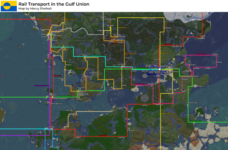
map of rail transport in and around the gulf union
File history
Click on a date/time to view the file as it appeared at that time.
| Date/Time | Thumbnail | Dimensions | User | Comment | |
|---|---|---|---|---|---|
| current | 03:26, 6 November 2025 | | 3,800 × 2,500 (13.93 MB) | Sheikah (talk | contribs) | |
| 18:16, 6 October 2025 | 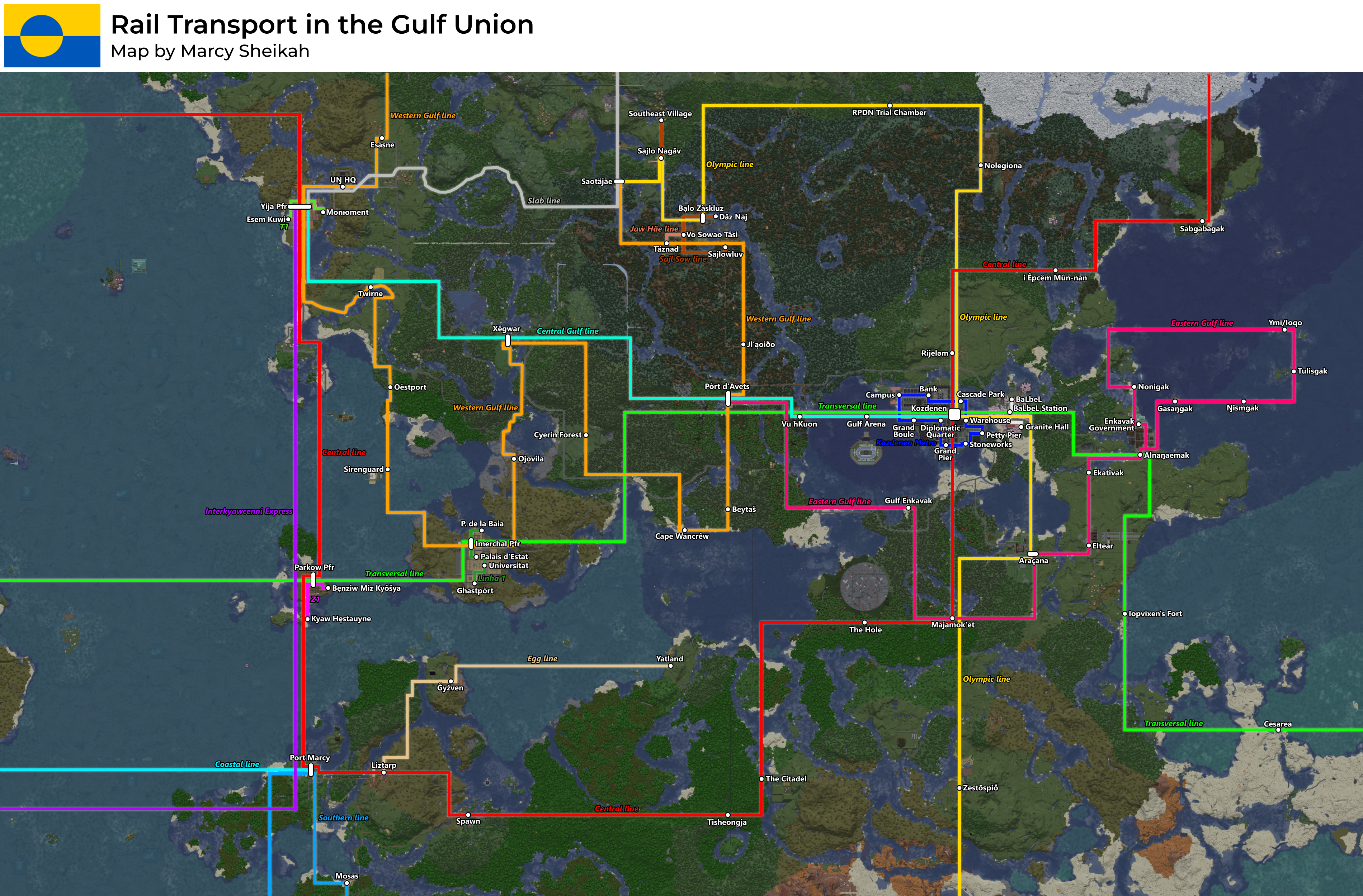 | 3,800 × 2,500 (13.93 MB) | Sheikah (talk | contribs) | ||
| 15:17, 4 October 2025 |  | 3,800 × 2,500 (13.91 MB) | Sheikah (talk | contribs) | ||
| 20:32, 1 October 2025 |  | 3,800 × 2,500 (13.93 MB) | Sheikah (talk | contribs) | ||
| 17:21, 10 September 2025 | 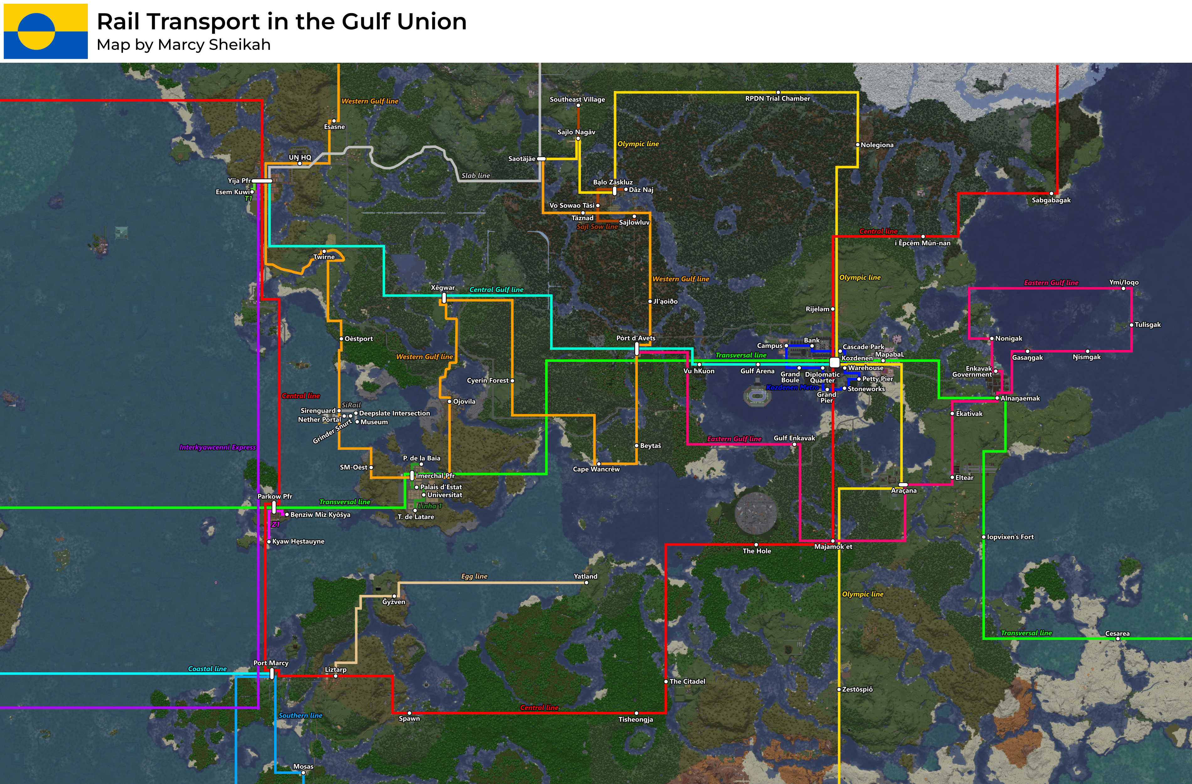 | 3,800 × 2,500 (13.93 MB) | Sheikah (talk | contribs) | ||
| 03:58, 28 August 2025 |  | 3,800 × 2,500 (13.92 MB) | Sheikah (talk | contribs) | ||
| 23:49, 26 August 2025 |  | 3,800 × 2,300 (13.86 MB) | Sheikah (talk | contribs) | marked koz metro line | |
| 19:11, 26 August 2025 | 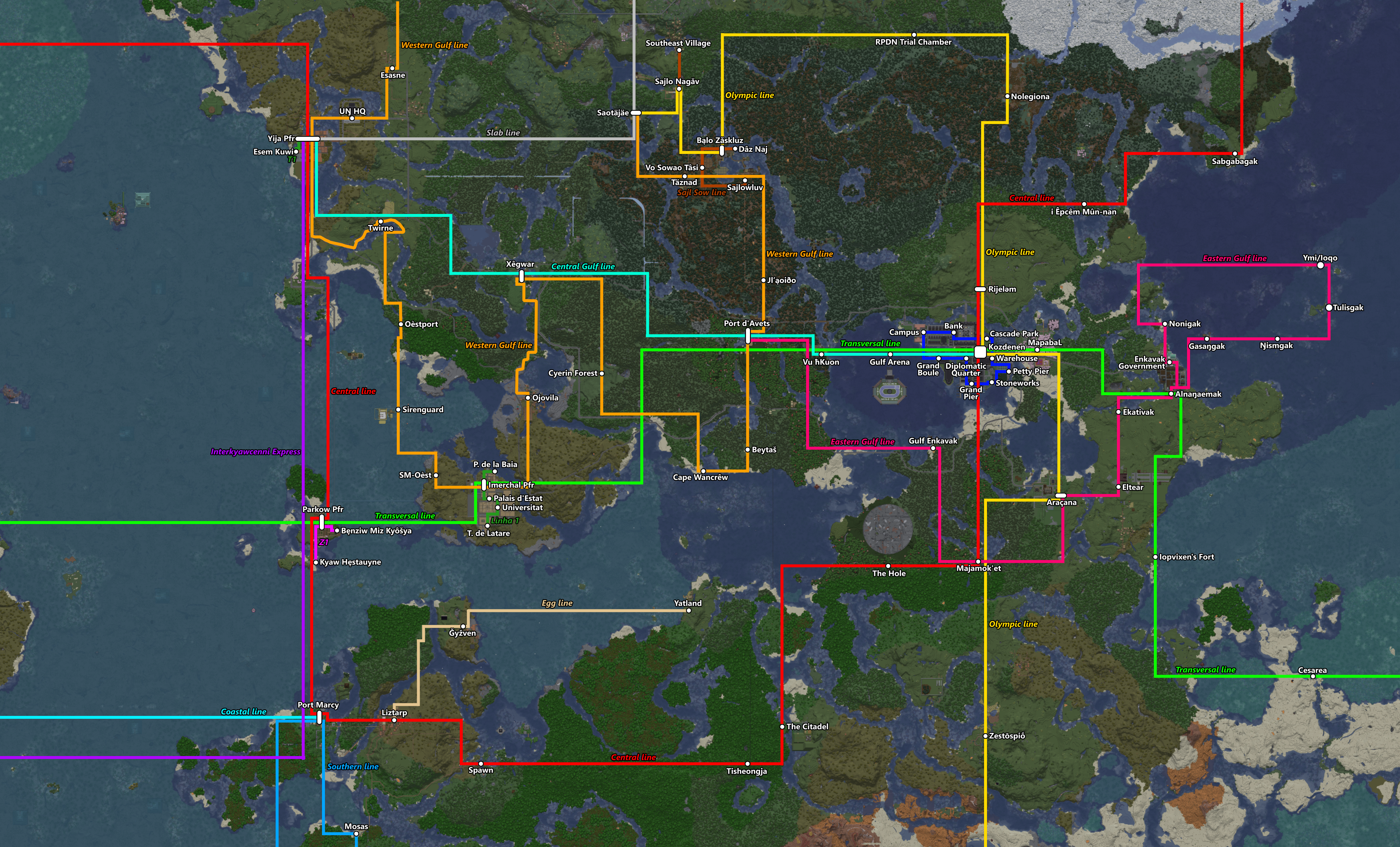 | 3,800 × 2,300 (13.86 MB) | Sheikah (talk | contribs) | ||
| 16:45, 25 August 2025 |  | 3,800 × 2,300 (13.86 MB) | Sheikah (talk | contribs) | ||
| 16:15, 25 August 2025 |  | 3,800 × 2,300 (13.86 MB) | Sheikah (talk | contribs) |
You cannot overwrite this file.
File usage
The following page uses this file: