File:Tour-de-nguh-map.png
Jump to navigation
Jump to search
Size of this preview: 580 × 600 pixels. Other resolutions: 1,981 × 2,048 pixels | 4,000 × 4,135 pixels.
Original file (4,000 × 4,135 pixels, file size: 7.09 MB, MIME type: image/png)
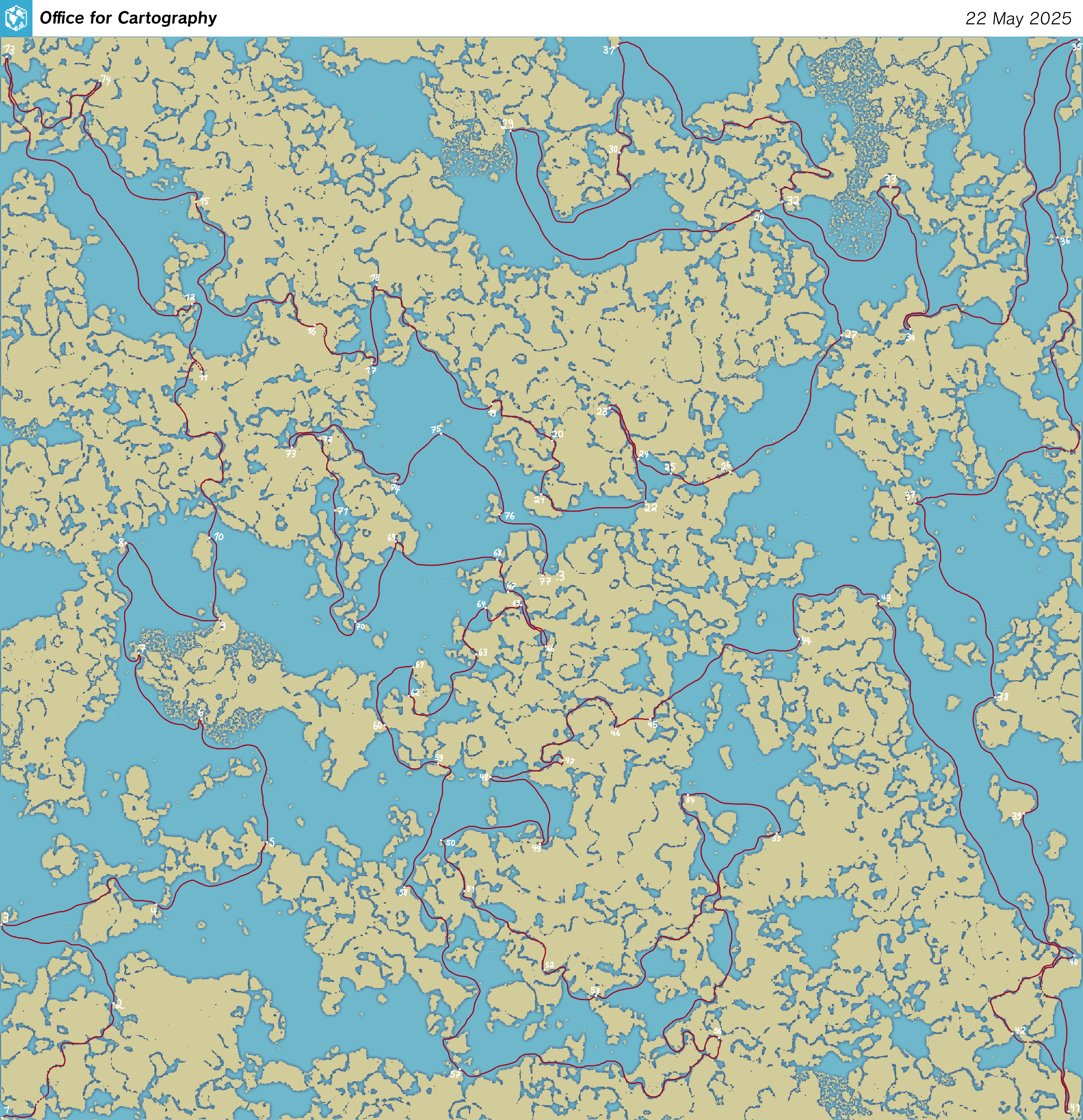
A map of all the tour de nguh checkpoints, and a suggested route. Overland trips are indicated with dashed lines.
File history
Click on a date/time to view the file as it appeared at that time.
| Date/Time | Thumbnail | Dimensions | User | Comment | |
|---|---|---|---|---|---|
| current | 22:38, 20 June 2025 | | 4,000 × 4,135 (7.09 MB) | Pikkuhiljaa (talk | contribs) |
You cannot overwrite this file.
File usage
The following page uses this file: