File:Coldban districts map.png

No higher resolution available.
Coldban_districts_map.png (752 × 599 pixels, file size: 735 KB, MIME type: image/png)
Coldban districts map
File history
Click on a date/time to view the file as it appeared at that time.
| Date/Time | Thumbnail | Dimensions | User | Comment | |
|---|---|---|---|---|---|
| current | 22:03, 6 January 2026 | | 752 × 599 (735 KB) | Suqi (talk | contribs) | |
| 21:43, 6 September 2025 | 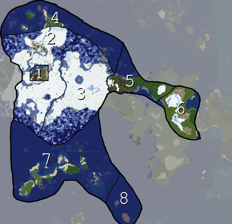 | 800 × 771 (795 KB) | Suqi (talk | contribs) |
You cannot overwrite this file.
File usage
The following page uses this file: