File:Nguhcraft minimap kyawcen.png
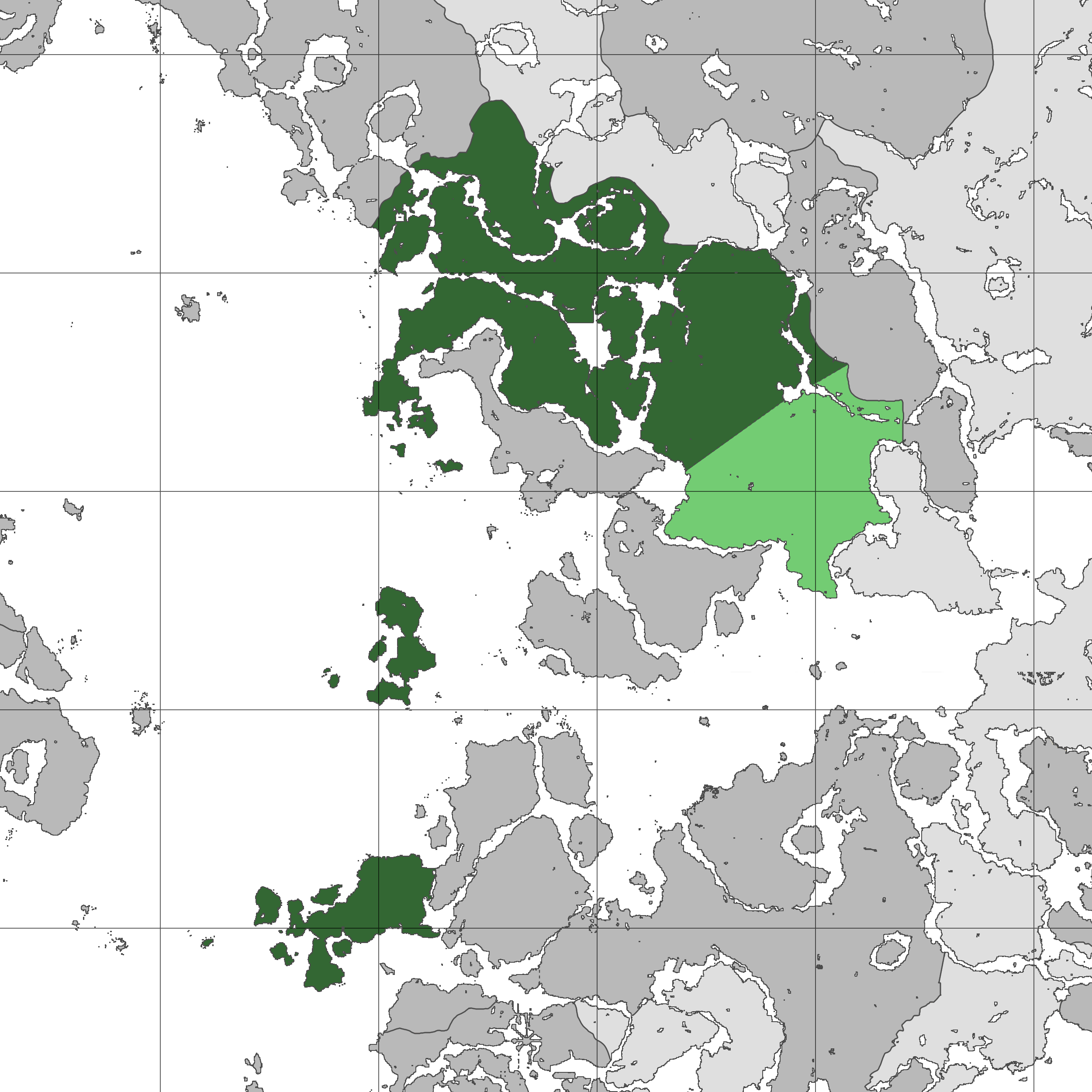
Size of this preview: 600 × 600 pixels. Other resolution: 2,500 × 2,500 pixels.
Original file (2,500 × 2,500 pixels, file size: 440 KB, MIME type: image/png)
File history
Click on a date/time to view the file as it appeared at that time.
| Date/Time | Thumbnail | Dimensions | User | Comment | |
|---|---|---|---|---|---|
| current | 07:48, 12 April 2025 | | 2,500 × 2,500 (440 KB) | CMCollective (talk | contribs) | FINALLY marked Monke Island -Grönny |
| 01:59, 5 September 2024 |  | 2,500 × 2,500 (325 KB) | Zendrid (talk | contribs) | fixed northern border | |
| 01:57, 13 June 2024 |  | 600 × 600 (80 KB) | Dillon (talk | contribs) |
You cannot overwrite this file.
File usage
The following page uses this file: