File:Pua-Minor-map.png

Size of this preview: 600 × 600 pixels. Other resolution: 1,450 × 1,450 pixels.
Original file (1,450 × 1,450 pixels, file size: 1.37 MB, MIME type: image/png)
Map of Scarecrow Harbor and its surroundings
File history
Click on a date/time to view the file as it appeared at that time.
| Date/Time | Thumbnail | Dimensions | User | Comment | |
|---|---|---|---|---|---|
| current | 16:18, 29 May 2025 | | 1,450 × 1,450 (1.37 MB) | Sheikah (talk | contribs) | |
| 20:08, 13 March 2025 | 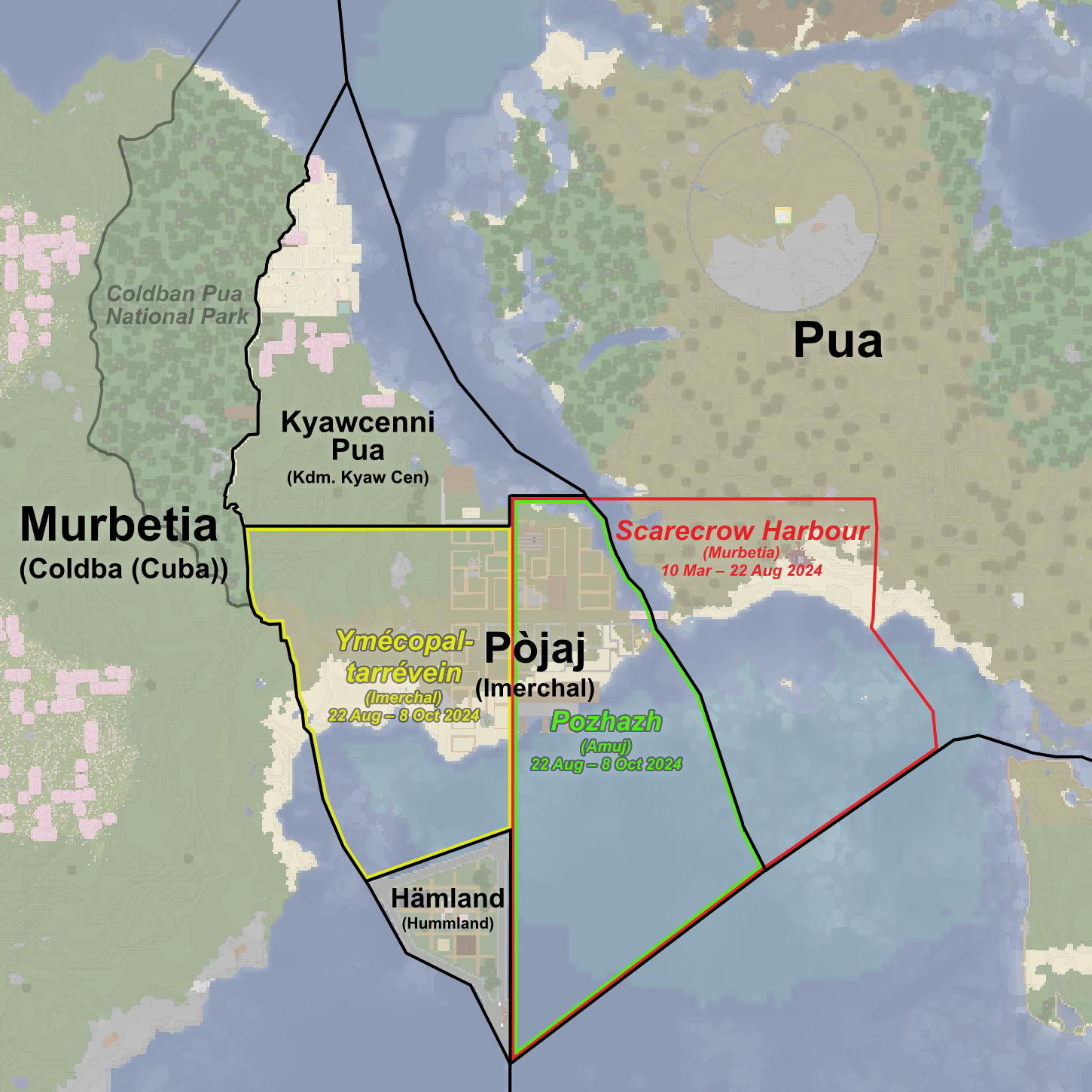 | 1,450 × 1,450 (1.41 MB) | Sheikah (talk | contribs) | Pua | |
| 18:36, 17 November 2024 | 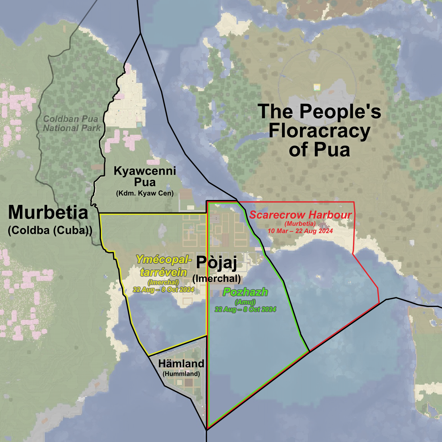 | 1,450 × 1,450 (1.43 MB) | Sheikah (talk | contribs) | ||
| 20:33, 12 October 2024 |  | 1,450 × 1,450 (1.39 MB) | Sheikah (talk | contribs) | added the national park | |
| 22:00, 11 October 2024 |  | 1,450 × 1,450 (1.37 MB) | Sheikah (talk | contribs) | updated pojaj and stuff, added historical borders | |
| 01:19, 23 August 2024 |  | 1,185 × 1,635 (1.12 MB) | Sheikah (talk | contribs) | updated it | |
| 17:39, 22 August 2024 | 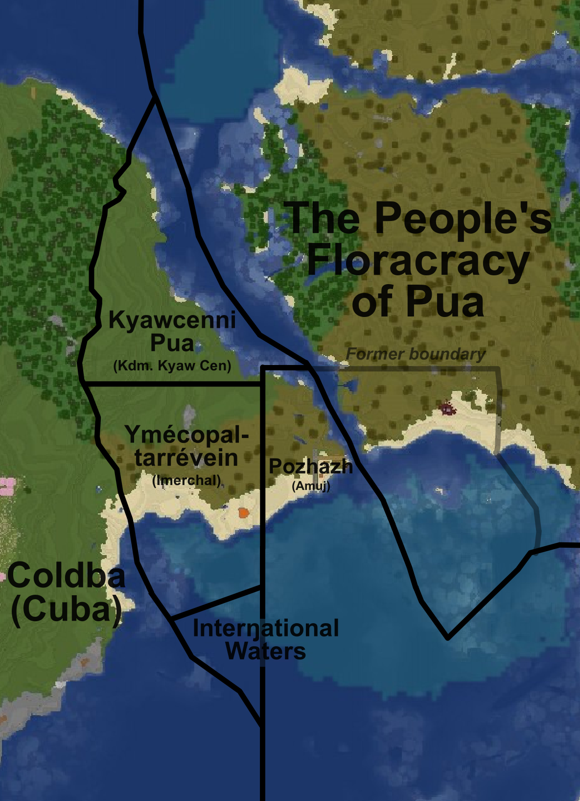 | 1,185 × 1,635 (673 KB) | Sheikah (talk | contribs) |
You cannot overwrite this file.
File usage
The following 9 pages use this file:
- Amujan Pozhazh
- Hämburg
- Pojaj
- Pua Minor
- File:Scarecrow-harbor.png (file redirect)
- File:Scarecrow-harbour-partition-map.png (file redirect)