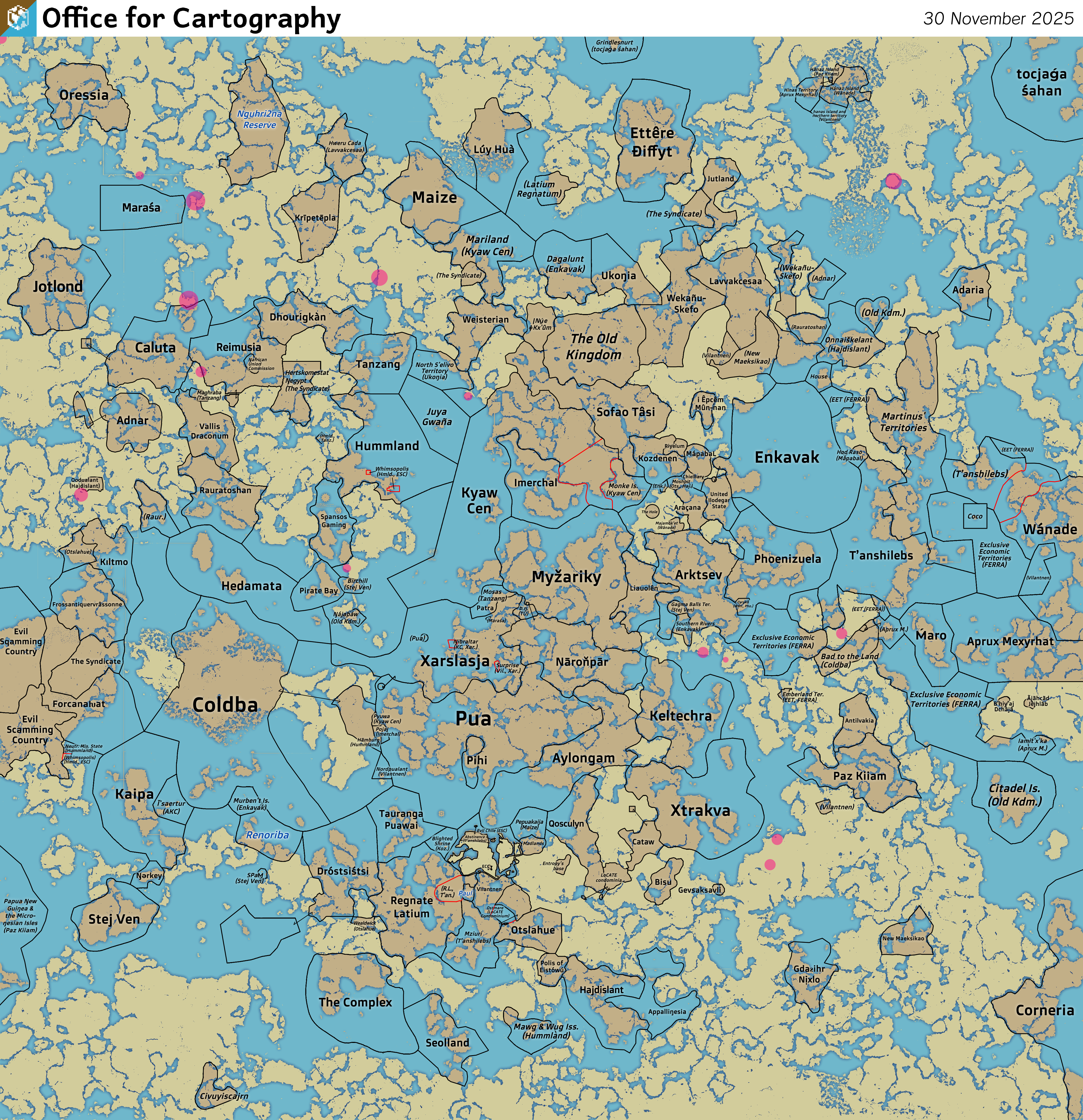
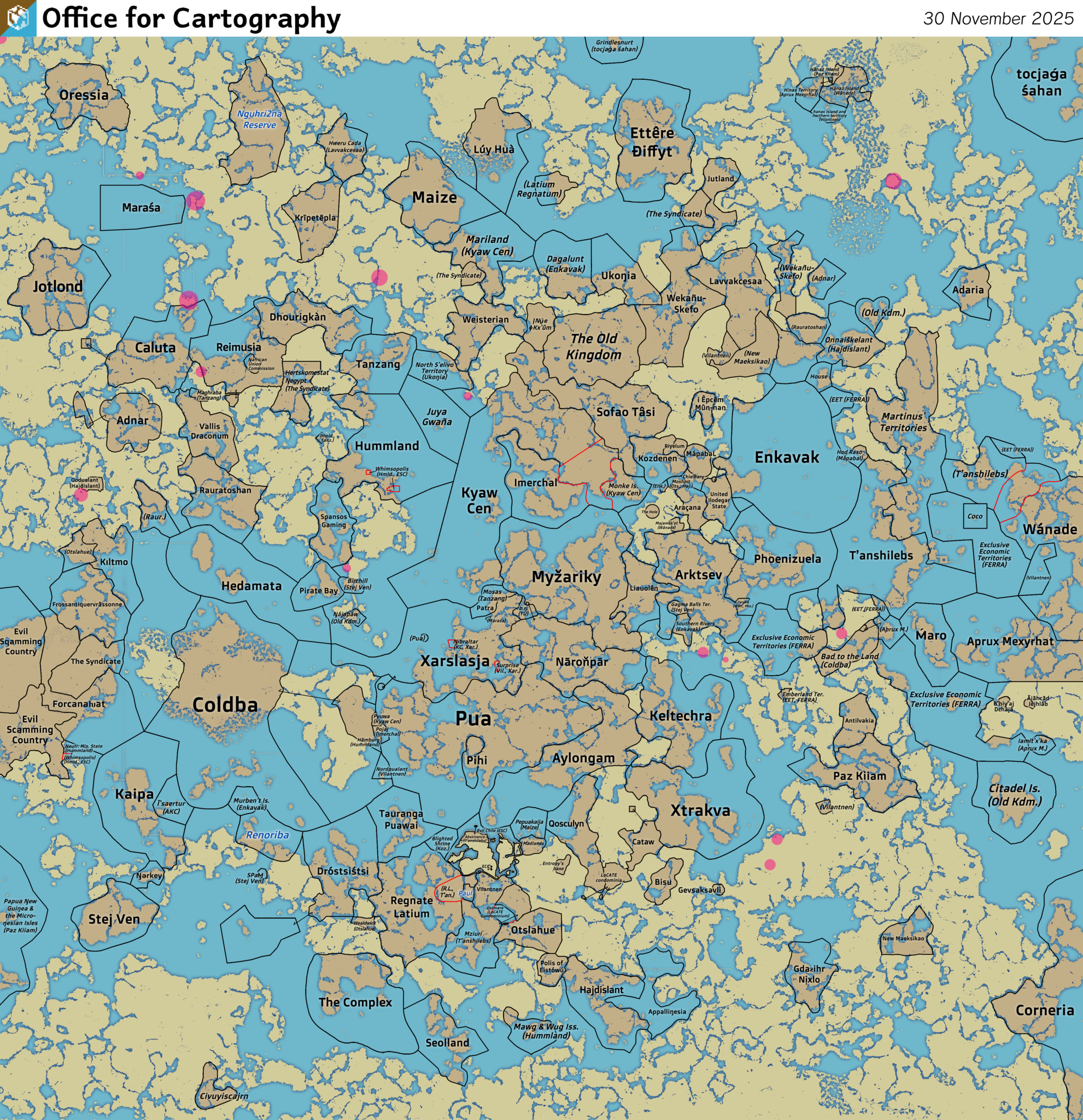
File:Nguhcraft-map.png
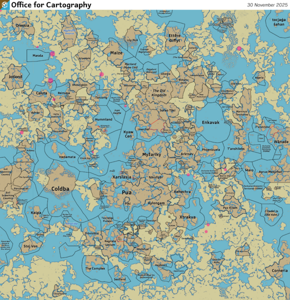
Size of this preview: 580 × 600 pixels. Other resolutions: 1,981 × 2,048 pixels | 3,992 × 4,127 pixels.
Original file (3,992 × 4,127 pixels, file size: 5.88 MB, MIME type: image/png)
Political map of Nguhcraft
File history
Click on a date/time to view the file as it appeared at that time.
| Date/Time | Thumbnail | Dimensions | User | Comment | |
|---|---|---|---|---|---|
| 15:53, 26 May 2025 | 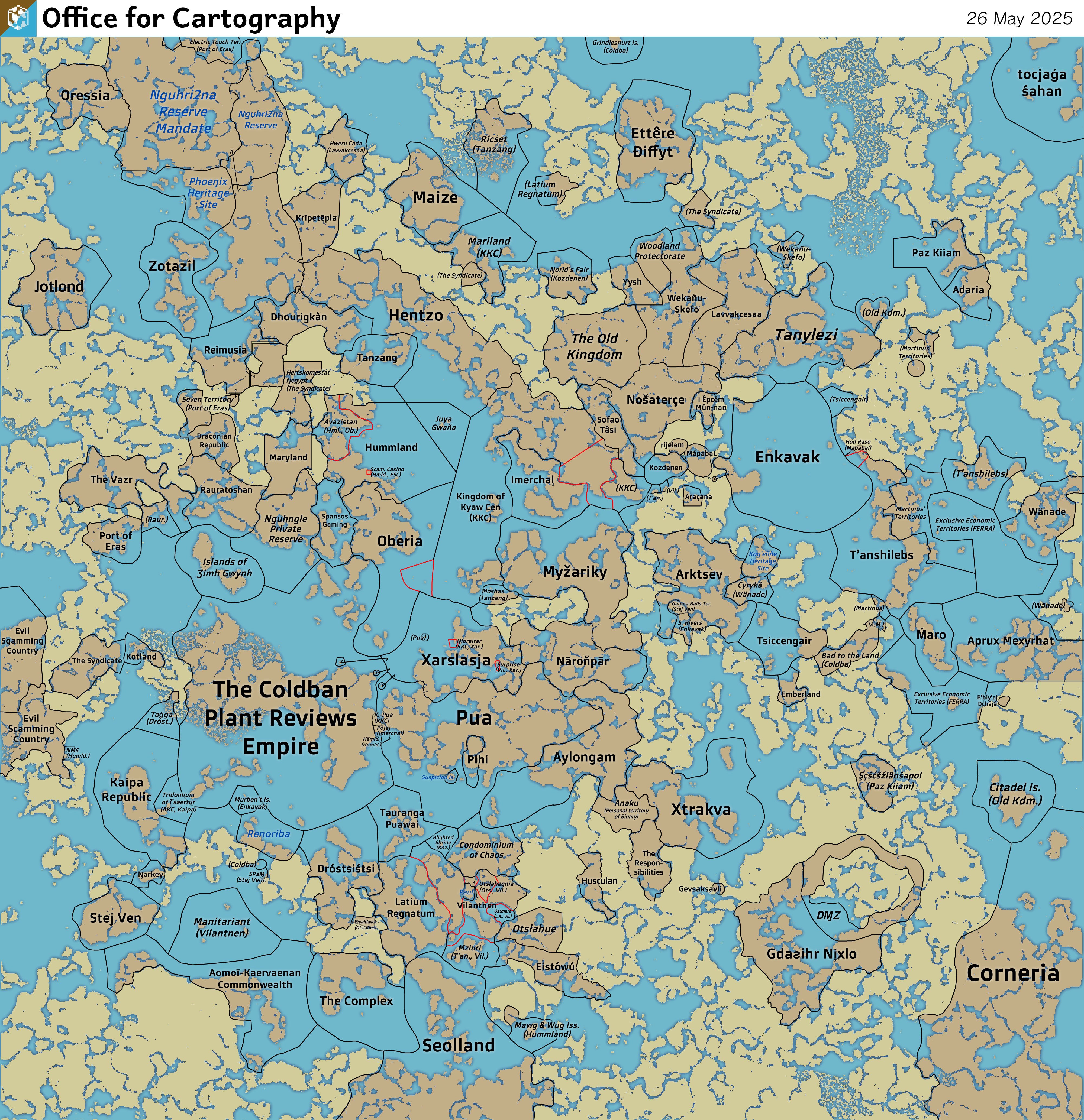 | 4,000 × 4,135 (7.78 MB) | Sheikah (talk | contribs) | ||
| 15:23, 26 May 2025 | 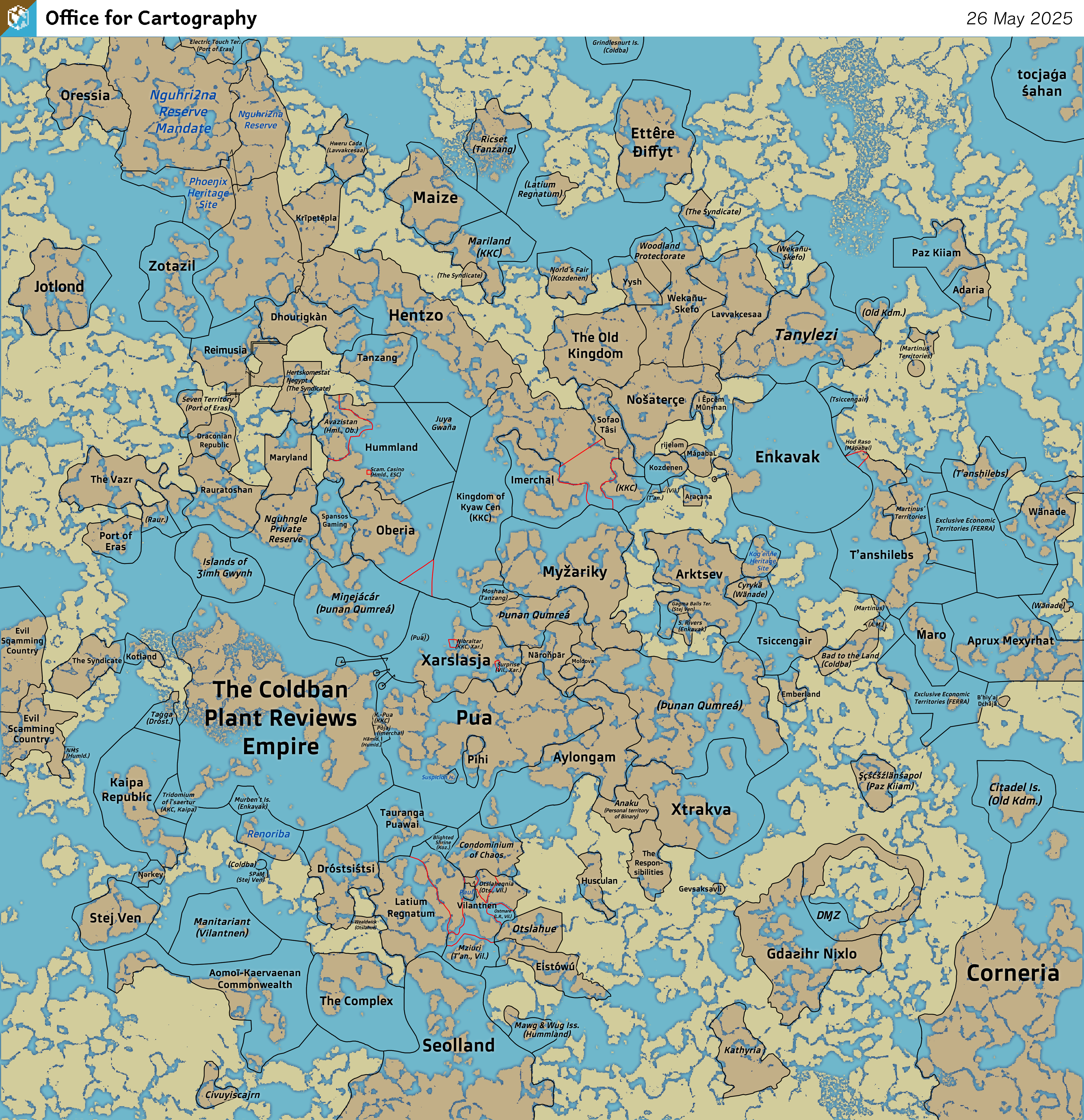 | 4,000 × 4,135 (7.84 MB) | Sheikah (talk | contribs) | ||
| 15:56, 16 May 2025 | 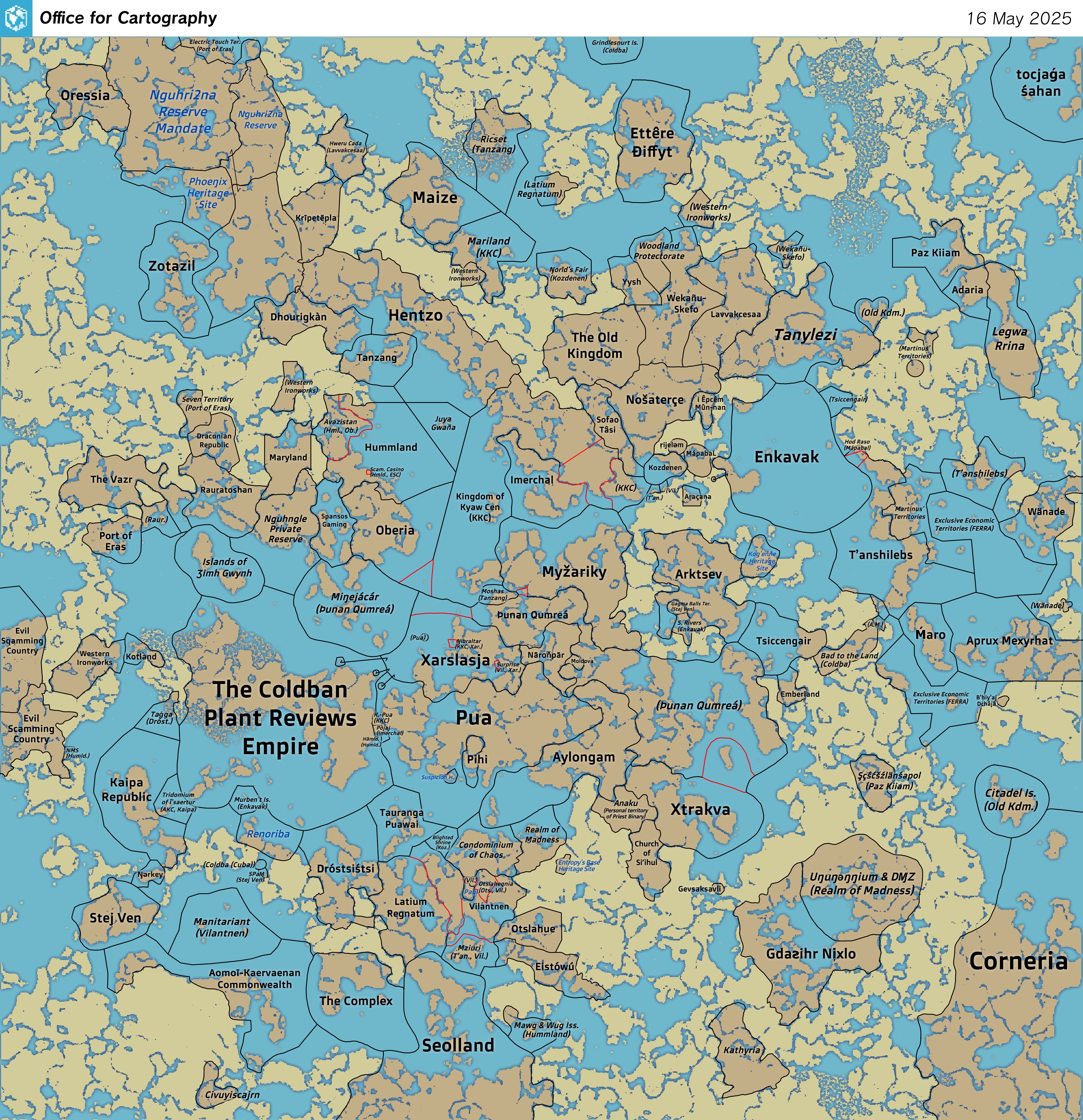 | 4,000 × 4,135 (7.83 MB) | Sheikah (talk | contribs) | ||
| 23:45, 29 April 2025 | 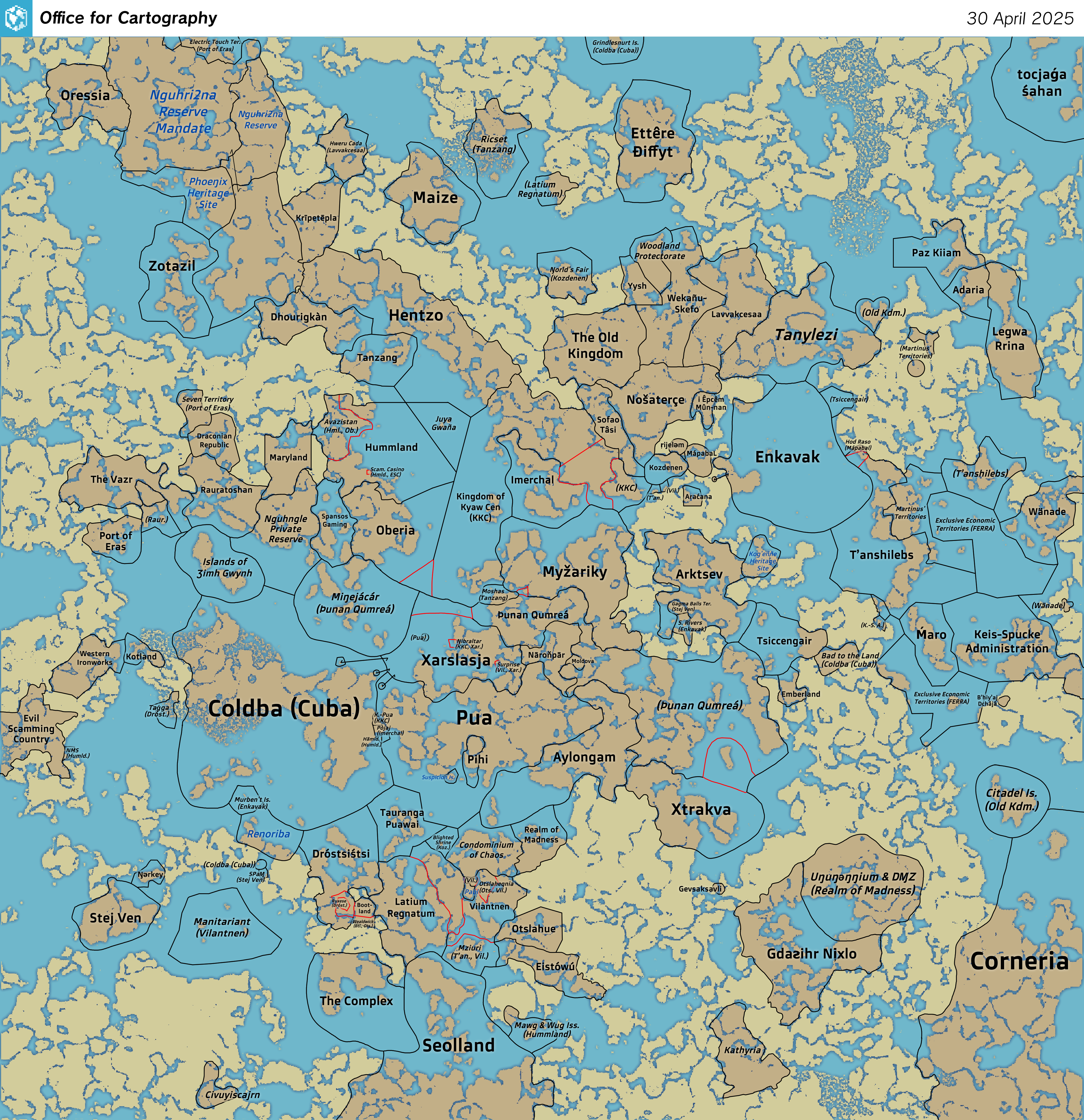 | 4,000 × 4,135 (7.61 MB) | Sheikah (talk | contribs) | ||
| 00:19, 23 April 2025 | 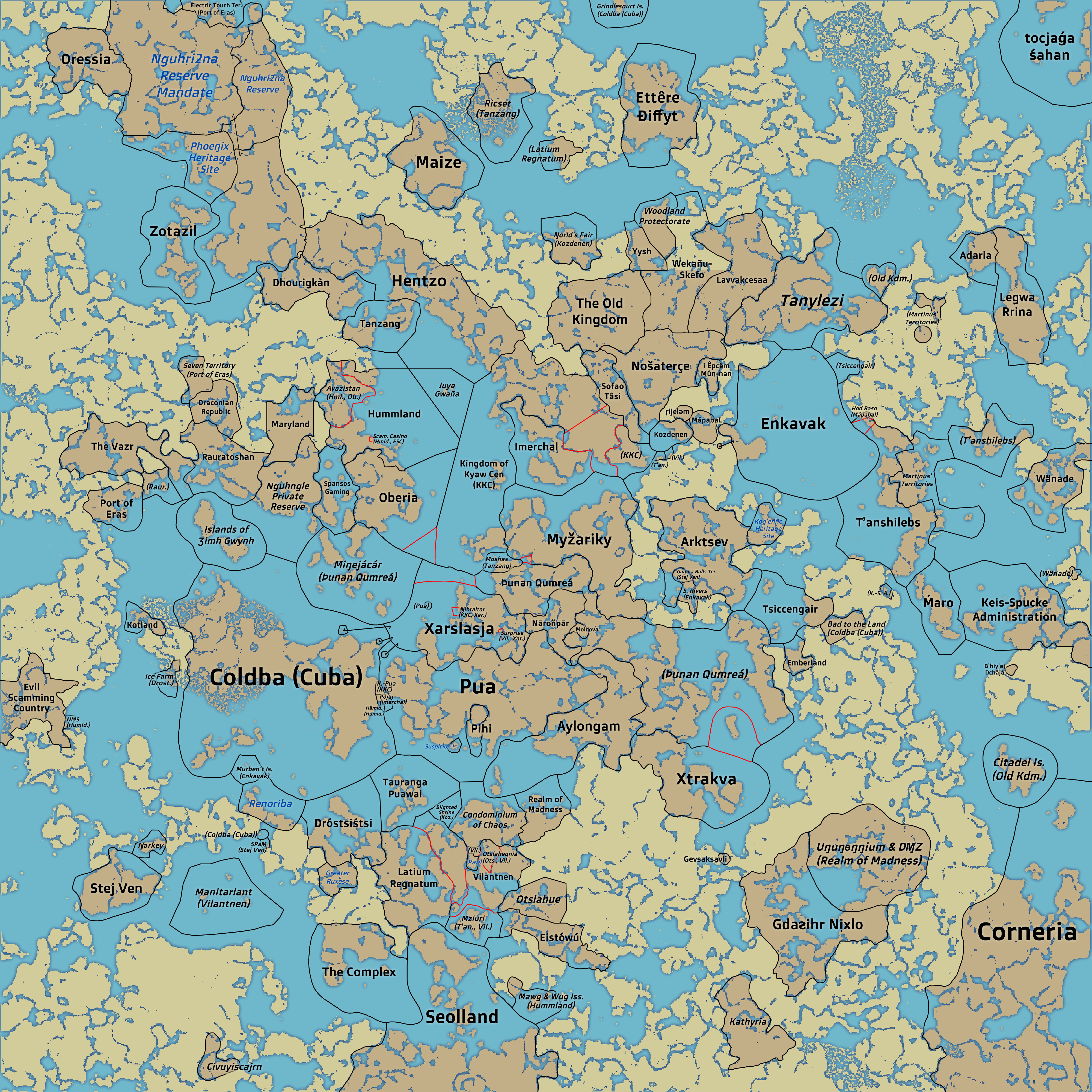 | 4,000 × 4,000 (7.48 MB) | Sheikah (talk | contribs) | woodland prot., keis | |
| 17:53, 21 April 2025 | 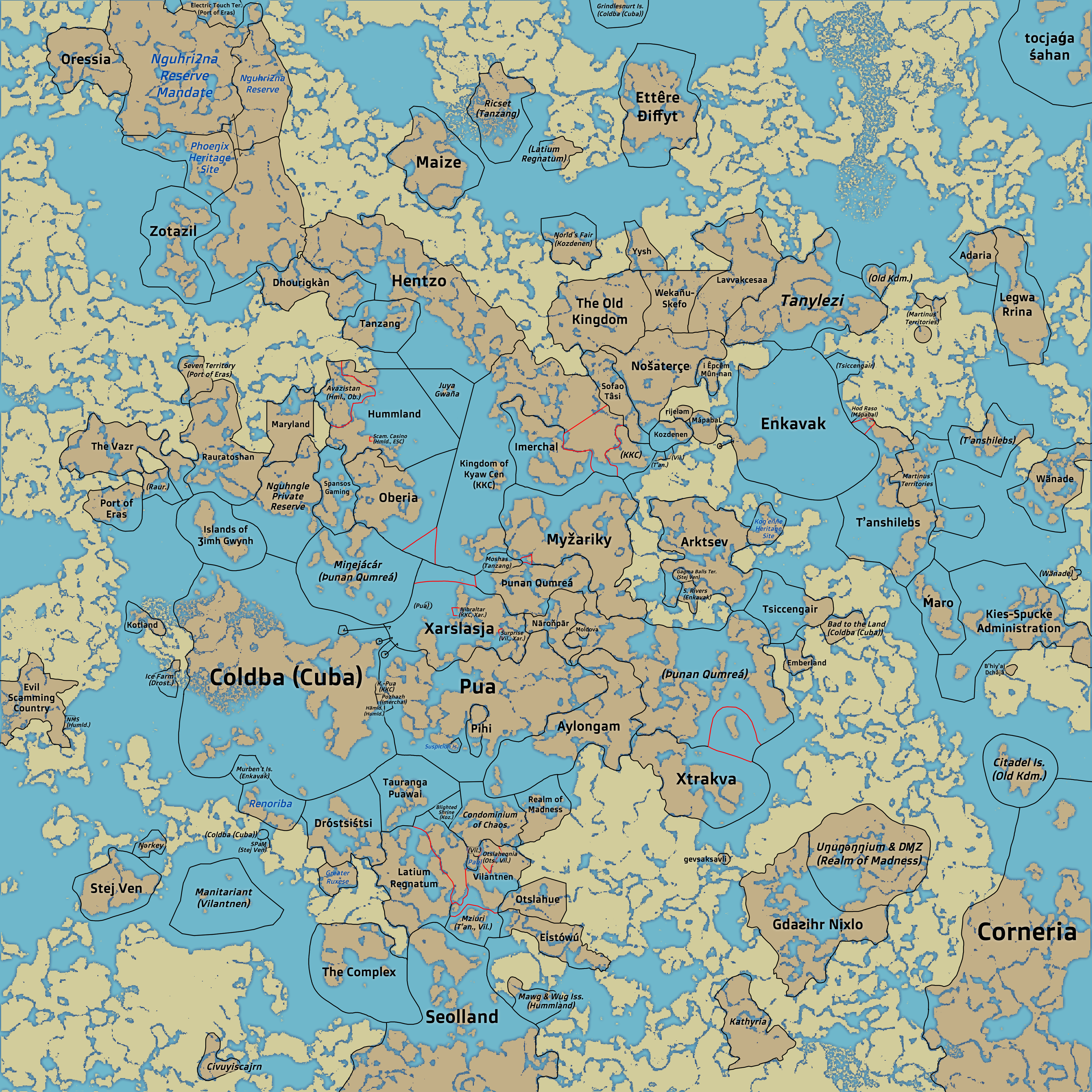 | 4,000 × 4,000 (7.44 MB) | Sheikah (talk | contribs) | added new countries, gevsaksavli and martinus' territories and corrected manitariant | |
| 00:36, 21 April 2025 |  | 4,000 × 4,000 (7.32 MB) | Sheikah (talk | contribs) | thunan thar condominium | |
| 00:26, 21 April 2025 |  | 4,000 × 4,000 (7.32 MB) | Sheikah (talk | contribs) | Slightly improved the borders in the sea of fortune and made tanylezi italic | |
| 23:45, 20 April 2025 | 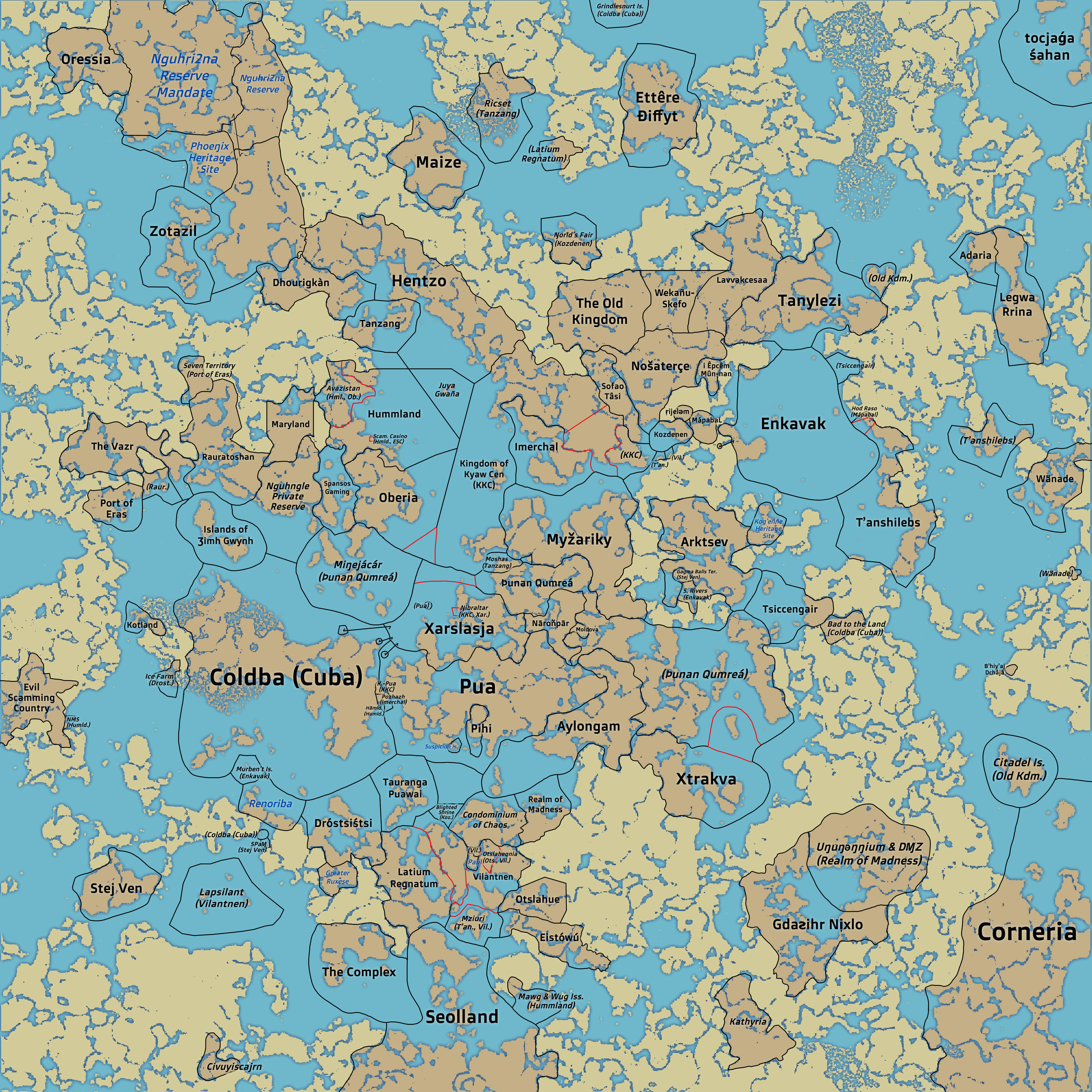 | 4,000 × 4,000 (7.32 MB) | Sheikah (talk | contribs) | ||
| 23:29, 20 April 2025 |  | 4,000 × 4,000 (7.32 MB) | Sheikah (talk | contribs) |
You cannot overwrite this file.
File usage
The following page uses this file: