United Ŋations Office for Cartography

The United Ŋations Office for Cartography (OfC or UŊCO) is an office of the United Ŋations whose job is keeping a political map of Nguhcraft up-to-date. The release date at the top left of the map was based on Central European Time. The first and current UŊ cartographer is Marcy Sheikah, who has created the first ever political maps of Nguhcraft before quitting due to technical limitations on 24 April 2024. Since then Ætérnal had been maintaining the primary map of Nguhcraft until 5 December 2024. Having created the participation map for the Nguhrovision Song Contest 2024, Sheikah returned to create of similar, more minimalist recent political maps of Nguhcraft. Zendrid also works for the office, having created the locator maps for this Wiki.
Most recent political map
The following are the two versions of the most recent official political map of Nguhcraft, created on 06 September 2025 by Marcy Sheikah.
-
Political satellite map of Nguhcraft by Marcy Sheikah
-
Political map of Nguhcraft by Marcy Sheikah
Other maps
-
Blank map of Nguhcraft with borders by Marcy Sheikah
-
Blank map of Nguhcraft without borders by Marcy Sheikah
-
Blank map of Nguhcraft with major bodies of water by Marcy Sheikah and Suqi
-
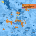
The official map for participants of the Nguhrovision Song Contest 2024 was being kept up to date by Marcy Sheikah from the UŊ Office for Cartography.
-
The official map for participants of the Nguhrovision Song Contest 2025 is being kept up to date by Marcy Sheikah from the UŊ Office for Cartography.
-
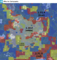
A map of Minecraft versions by region drawn by Marcy Sheikah from the UŊ Office for Cartography.
-
The latest version of Ætérnal's UŊ Map from 5 December 2024
-
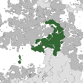
The official map of members of the United Ŋations is being kept up to date by Zendrid from the UŊ Office for Cartography.
-
The minimaps for this Wiki are being kept up to date by Zendrid from the UŊ Office for Cartography.
Ætérnal's december 2024 world map
Due to technical limitations, the version of the map shown on this wiki is only a preview of the actual map. The actual map is a 16000×16000 image that, even when compressed using lossy compression with some of the better image compression formats, still takes up ~100MB of space, which is why the latest version of the map is instead hosted on nguh.org:
- 1:2 version (WEBP, <unknown file>): https://www.nguh.org/static/mc/map.webp
- 1:1 version (WEBP, lossless, 270.32 MiB): https://www.nguh.org/static/mc/map-full-size.webp
- Background (JPEG XL, lossless, <unknown file>): https://www.nguh.org/static/mc/map.jxl
History

The first post-raid attempt at a political map of Nguhcraft was the Big Map made by self-proclaimed Map Nerd and Quing of Kyaw Cen Marcy I on 2 January 2024, one month before the founding of the UŊ. Marcy Sheikah was the first person to maintain the UŊ Official Map when the United Ŋations Office for Cartography was later established. However, she de facto resigned on 24 April 2024 due to her computer having problems editing the map since it is so large, and Ætérnal has been maintaining the map until 2025, when Sheikah returned to making political maps of Nguhcraft.
- UŊ Official Map, full-size version (<unknown file>): https://www.nguh.org/static/mc/marcy-ung-map.png
-
The last version of the UŊ Official Map by Marcy from 24 April 2024
-
First edition of the Big Map, the predecessor to the UŊ Official Map
United Ŋations geoscheme
- Main article: Continent
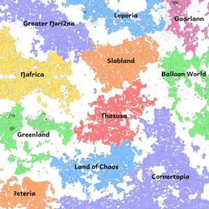
The United Ŋations geoscheme suggested by Marcy Sheikah on 06 May 2024 divides the world into 11 superŋational regions (or continents). Most names of those continents are only supposed to be temporary: On 23 January 2025, the continent of Cornertopia was divided in two halves, Tardigradia and Aŋtarctica, changing the number of continents to 12.
- Aŋtarctica (formerly considered part of Cornertopia)
- Archipelagia (formerly Greenland)
- Gaarlann
- Gadicinta (formerly Balloon World)
- Hlambigla
- Land of Chaos
- Leporia (formerly Leporia Land)
- Ŋafrica
- Slabland
- Tardigradia (formerly considered part of Cornertopia)
- Thasusa
- ʡeteria
List of UŊCO world map cartographers
| Photo | Name | From | Until |
|---|---|---|---|
 |
02 January 2024[1] | 24 April 2024[2] | |
 |
24 April 2024[3] | 5 December 2024 (last map) 29 April 2025 (formally)[4] | |
 |
21 April 2025 (first map)[5] 29 April 2025 (formally)[6] |
Incumbent |
Footnotes
- ↑ https://discord.com/channels/697450809390268467/835185858864218122/1191543350663331870
- ↑ https://discord.com/channels/697450809390268467/767569743229747220/1232765440728502355
- ↑ https://discord.com/channels/697450809390268467/767569743229747220/1232767442426658876
- ↑ https://discord.com/channels/697450809390268467/767569743229747220/1366893090110967899
- ↑ https://discord.com/channels/697450809390268467/1268387836835397653/1363964456664563822
- ↑ https://discord.com/channels/697450809390268467/767569743229747220/1366893090110967899


