File:Nguhrovision-2024-map.png
Jump to navigation
Jump to search
Size of this preview: 600 × 600 pixels. Other resolution: 2,497 × 2,497 pixels.
Original file (2,497 × 2,497 pixels, file size: 1.83 MB, MIME type: image/png)
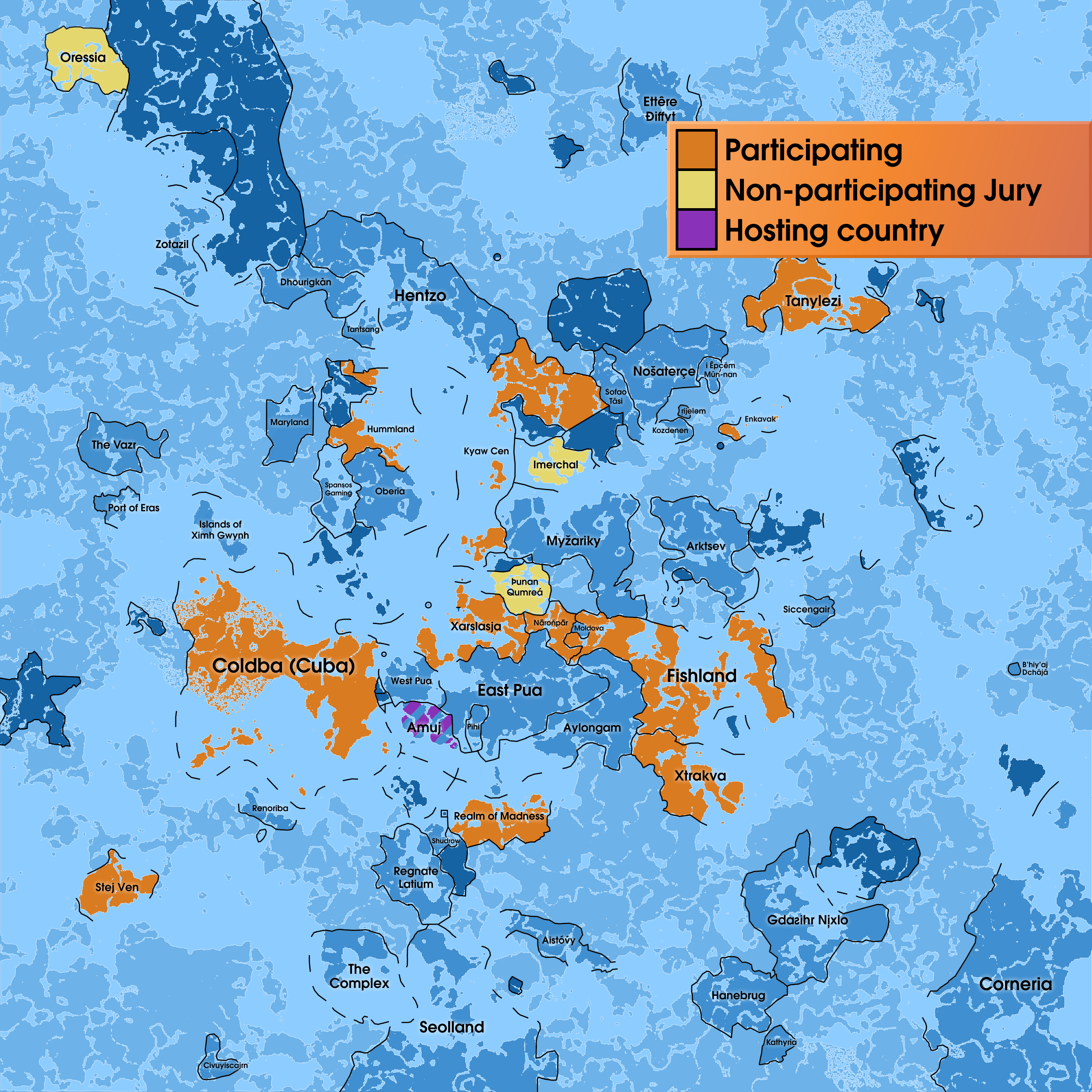
Blue: Participating countries
Green: Countries considering participation
Yellow: Countries whose participation has been withdrawn
Gray: Countries not considering participation
Dark gray: Disputed territory, condominiums, colonies, UŊ protected areas
Light gray: terra nullius
White: water
File history
Click on a date/time to view the file as it appeared at that time.
| Date/Time | Thumbnail | Dimensions | User | Comment | |
|---|---|---|---|---|---|
| 15:21, 30 June 2024 |  | 2,497 × 2,497 (962 KB) | Sheikah (talk | contribs) | added imersial | |
| 21:57, 29 June 2024 |  | 2,497 × 2,497 (961 KB) | Sheikah (talk | contribs) | forgot rijelam existed lol | |
| 10:56, 29 June 2024 |  | 2,497 × 2,497 (960 KB) | Sheikah (talk | contribs) | added dhourigkàn and extravak | |
| 15:02, 26 June 2024 |  | 2,497 × 2,497 (960 KB) | Sheikah (talk | contribs) | ||
| 14:57, 26 June 2024 | 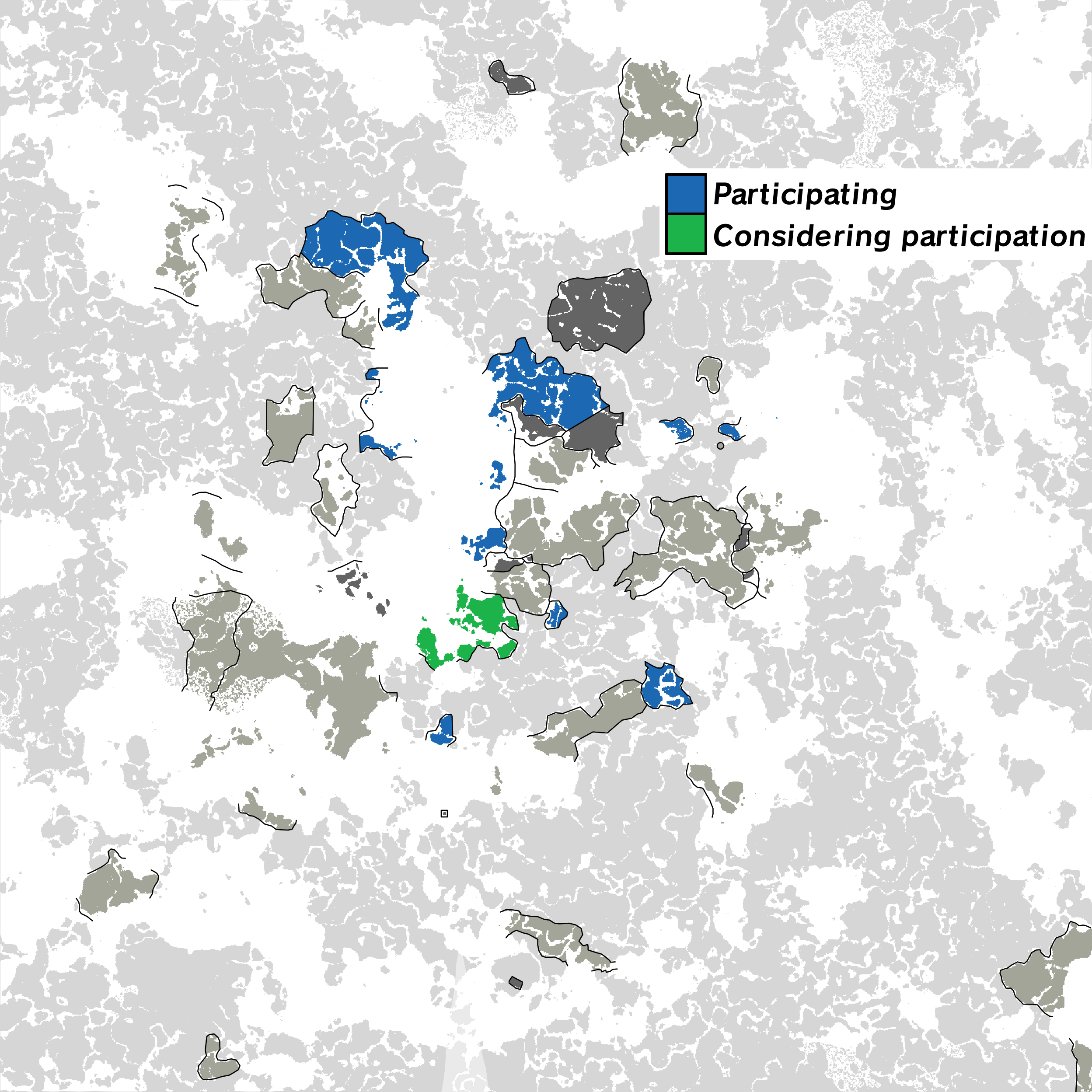 | 2,497 × 2,497 (960 KB) | Sheikah (talk | contribs) | added rkdabsimo and fenizuela; darkened the old kingdom and magw | |
| 22:24, 25 June 2024 |  | 2,497 × 2,497 (942 KB) | Sheikah (talk | contribs) |
You cannot overwrite this file.
File usage
The following 9 pages use this file: