File:Thasusa Road Grid.png
Jump to navigation
Jump to search
Size of this preview: 731 × 600 pixels. Other resolution: 834 × 684 pixels.
Original file (834 × 684 pixels, file size: 1.02 MB, MIME type: image/png)
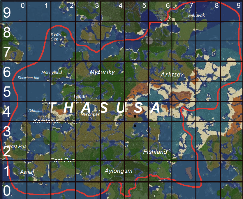
This map shows what number in the tens place each TBL-approved road should have. Large numbers listed vertically denote the tens place of east-west roads; small numbers listed horizontally denote the tens place of primarily north-south roads.
File history
Click on a date/time to view the file as it appeared at that time.
| Date/Time | Thumbnail | Dimensions | User | Comment | |
|---|---|---|---|---|---|
| current | 17:44, 5 April 2025 | | 834 × 684 (1.02 MB) | BezuvNguh (talk | contribs) |
You cannot overwrite this file.
File usage
The following page uses this file: